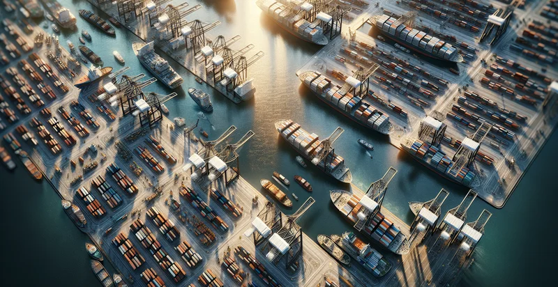
Identify aerial views of shipyards
using AI
Below is a free classifier to identify aerial views of shipyards. Just upload your image, and our AI will predict if it's a busy shipyard - in just seconds.

Contact us for API access
Or, use Nyckel to build highly-accurate custom classifiers in just minutes. No PhD required.
Get started
    import nyckel

    credentials = nyckel.Credentials("YOUR_CLIENT_ID", "YOUR_CLIENT_SECRET")
    nyckel.invoke("aerial-views-of-shipyards", "your_image_url", credentials)
    fetch('https://www.nyckel.com/v1/functions/aerial-views-of-shipyards/invoke', {
        method: 'POST',
        headers: {
            'Authorization': 'Bearer ' + 'YOUR_BEARER_TOKEN',
            'Content-Type': 'application/json',
        },
        body: JSON.stringify(
            {"data": "your_image_url"}
        )
    })
    .then(response => response.json())
    .then(data => console.log(data));
    curl -X POST \
        -H "Content-Type: application/json" \
        -H "Authorization: Bearer YOUR_BEARER_TOKEN" \
        -d '{"data": "your_image_url"}' \
        https://www.nyckel.com/v1/functions/aerial-views-of-shipyards/invoke
How this classifier works
To start, upload your image. Our AI tool will then predict if it's a busy shipyard.
This pretrained image model uses a Nyckel-created dataset and has 2 labels, including Container Ships and Dry Docks.
We'll also show a confidence score (the higher the number, the more confident the AI model is around if it's a busy shipyard).
Whether you're just curious or building aerial views of shipyards detection into your application, we hope our classifier proves helpful.
Related Classifiers
Need to identify aerial views of shipyards at scale?
Get API or Zapier access to this classifier for free. It's perfect for:
- Inventory Management: The aerial image classification function can help shipyard managers monitor and assess inventory levels of ships and materials. By analyzing aerial views, decision-makers can optimize storage, streamline operations, and reduce costs associated with overstock or shortages.
- Maintenance Planning: Shipyards can utilize aerial image classification to identify the condition and maintenance needs of vessels currently docked. This function enables more proactive planning for repairs, ensuring that ships are maintained efficiently, minimizing downtime, and extending their operational lifespan.
- Site Safety Monitoring: The classification of aerial views can assist in monitoring safety compliance across the shipyard. By assessing layouts and worker activities from above, management can identify potentially hazardous situations and implement necessary safety protocols to protect personnel.
- Resource Allocation: Analysts can leverage aerial image classification to visualize the spatial distribution of resources across a shipyard. This data allows for better allocation of manpower and machinery, optimizing workflows and productivity in various shipyard operations such as construction, repair, and maintenance.
- Environmental Impact Assessment: Shipyards can use this technology to monitor and evaluate environmental compliance by observing operational impacts from an aerial perspective. By classifying areas of potential environmental concern, yards can assess their ecological footprint and implement sustainable practices.
- Project Planning and Design: During the shipbuilding process, aerial image classification can assist engineers and architects in visualizing the shipyard layout to inform project design. This function allows for the effective allocation of space and resources for new projects, ensuring efficient utilization of the site.
- Market Analysis and Competitor Monitoring: Businesses can employ aerial views of competitor shipyards to gather insights into operational scales and capacities. By analyzing these aerial classifications, companies can enhance their market strategies, identify opportunities for growth, and benchmark their performance against industry standards.


