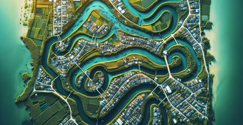
Identify aerial views of canals
using AI
Below is a free classifier to identify aerial views of canals. Just upload your image, and our AI will predict if the view depicts canals or not - in just seconds.

Contact us for API access
Or, use Nyckel to build highly-accurate custom classifiers in just minutes. No PhD required.
Get started
    import nyckel

    credentials = nyckel.Credentials("YOUR_CLIENT_ID", "YOUR_CLIENT_SECRET")
    nyckel.invoke("aerial-views-of-canals", "your_image_url", credentials)
    fetch('https://www.nyckel.com/v1/functions/aerial-views-of-canals/invoke', {
        method: 'POST',
        headers: {
            'Authorization': 'Bearer ' + 'YOUR_BEARER_TOKEN',
            'Content-Type': 'application/json',
        },
        body: JSON.stringify(
            {"data": "your_image_url"}
        )
    })
    .then(response => response.json())
    .then(data => console.log(data));
    curl -X POST \
        -H "Content-Type: application/json" \
        -H "Authorization: Bearer YOUR_BEARER_TOKEN" \
        -d '{"data": "your_image_url"}' \
        https://www.nyckel.com/v1/functions/aerial-views-of-canals/invoke
How this classifier works
To start, upload your image. Our AI tool will then predict if the view depicts canals or not.
This pretrained image model uses a Nyckel-created dataset and has 2 labels, including Nature and Urban.
We'll also show a confidence score (the higher the number, the more confident the AI model is around if the view depicts canals or not).
Whether you're just curious or building aerial views of canals detection into your application, we hope our classifier proves helpful.
Related Classifiers
Need to identify aerial views of canals at scale?
Get API or Zapier access to this classifier for free. It's perfect for:
- Urban Planning: This function can assist city planners in assessing the distribution of canals within urban environments. By analyzing aerial imagery, urban developers can optimize land use and enhance infrastructure planning around these waterways.
- Environmental Monitoring: Utilizing the canal identifier can help environmental scientists monitor water quality and habitats associated with canal systems. By regularly analyzing aerial imagery, they can detect changes in flora and fauna, which can indicate the health of the ecosystem.
- Flood Risk Management: This classification can support emergency management teams in identifying vulnerable canal areas that may be at risk of flooding. By analyzing the aerial views, agencies can develop mitigation strategies and response plans to manage flood risks effectively.
- Tourism Development: Tourism boards and local businesses can leverage the aerial view insights to promote recreational activities along scenic canals. By identifying and categorizing appealing canals, they can create marketing campaigns to attract visitors and residents alike.
- Real Estate Investment: Investors can use aerial imagery analysis to identify properties near valuable canal infrastructure. These insights can guide investment decisions, as properties near canals may be more desirable due to scenic views and potential for recreational activities.
- Agriculture Optimization: Farmers can benefit from aerial analysis of canals for irrigation planning. By understanding the location and flow of canals, they can make more informed decisions about water management and crop irrigation strategies, leading to improved yields.
- Transport and Infrastructure Analysis: Transportation agencies can utilize canal identification to assess the impact of canal systems on local transit routes. By analyzing aerial views, they can identify potential improvements in transport logistics, such as new paths or bridges that enhance connectivity.


